
Wake Forest Postal ZIP Coverage
Wake Forest’s official 2016-17 community guide lists 27587 and 27588. Archived USPS ZIP materials also list both codes with Wake Forest, North Carolina. The research supports a cautious reading: 27587 is the principal Wake Forest postal identity and many town addresses use it, while 27588 is documented in the Town guide and archived USPS material but no current retail assignment or exact delivery geography was located. Use the code as a postal fact, then verify an individual address with USPS and county mapping.
| ZIP | Areas Covered | Post Office | Notes |
|---|---|---|---|
| 27587 | Principal Wake Forest mailing identity and many town addresses | Wake Forest Post Office, 224 E. Holding Ave. | Public location page shows 27587-9998; verify individual address and route. |
| 27588 | Listed as Wake Forest in the Town guide and archived USPS material | Current retail assignment not located in the research | Do not assign a neighborhood or county from this code alone. |
A ZIP is a postal delivery construct. It is not a town-limit polygon, tax district, voter precinct, or deed jurisdiction. Wake Forest’s incorporated area is chiefly in Wake County, with a smaller incorporated part in Franklin County. A Wake Forest mailing address therefore does not identify the correct Register of Deeds, Clerk, elections office, or assessor without a county and physical-location check.
Wake Forest Post Office Details
The official USPS Wake Forest Post Office page lists the branch at 224 E. Holding Ave., Wake Forest, NC 27587-9998, with 919-556-8859. The page reports retail hours of Monday through Friday from 10 a.m. to 5 p.m. and Saturday from 10 a.m. to noon. It also lists PO Box access as 24/7. Those details describe the postal facility and available services, not the limits of a ZIP delivery area or the place where a resident record is held.
For a postal question, the branch page is useful for service information. For a parcel or public-record question, the next step is the full address and county jurisdiction. Postal labels can cross a municipal boundary, especially where the Wake Forest mailing identity is used outside corporate limits.
The official post-office location page supplies the local facility information associated with the primary Wake Forest ZIP.
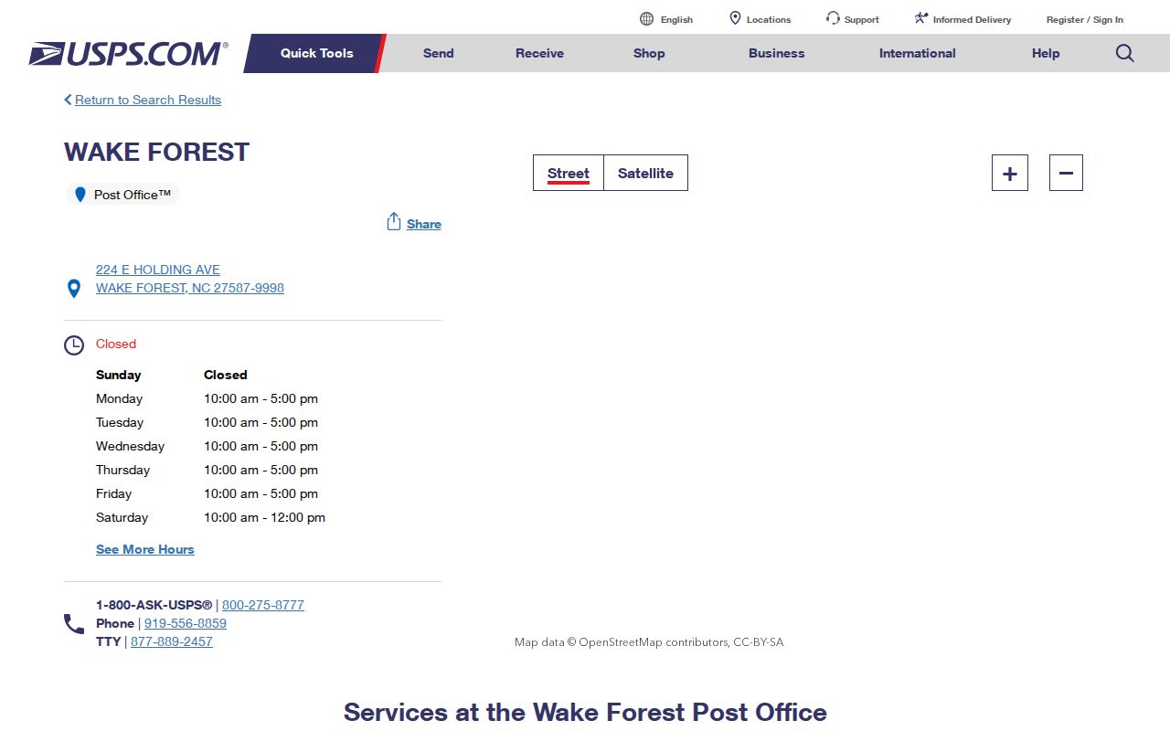
The image supports a postal-service check, while the parcel map and county boundary still control records routing.
Wake Forest ZIP Code Lookup Fields
The dynamic USPS ZIP Lookup provides three documented ways to check postal data: by address, by city and state, and by ZIP. The address form is the right starting point when the street and unit are known. Enter the full delivery address and compare the result with the county situs field, which is the physical property address used in parcel records. USPS warns that a lookup result does not confirm a particular person or company at an address.
| By Address | Street address, city, and state are required; company, unit, and a known ZIP are optional. |
|---|---|
| By City and State | City and state return ZIP choices attached to that postal city. |
| Cities by ZIP | A ZIP returns associated postal city and state information. |
| Find | Runs the selected lookup mode. |
USPS AIS Viewer is another postal product. Its inspected page described city, state, delivery type, ZIP, post office, county, ZIP+4, and address-lookup products, with a current update shown on August 24, 2026 and monthly updates. The research describes limited lookup access and a paid or subscriber product for broader AIS use, so it should not be treated as a free bulk directory.
The USPS Address Information System viewer shows the postal data product used to evaluate address and delivery information.
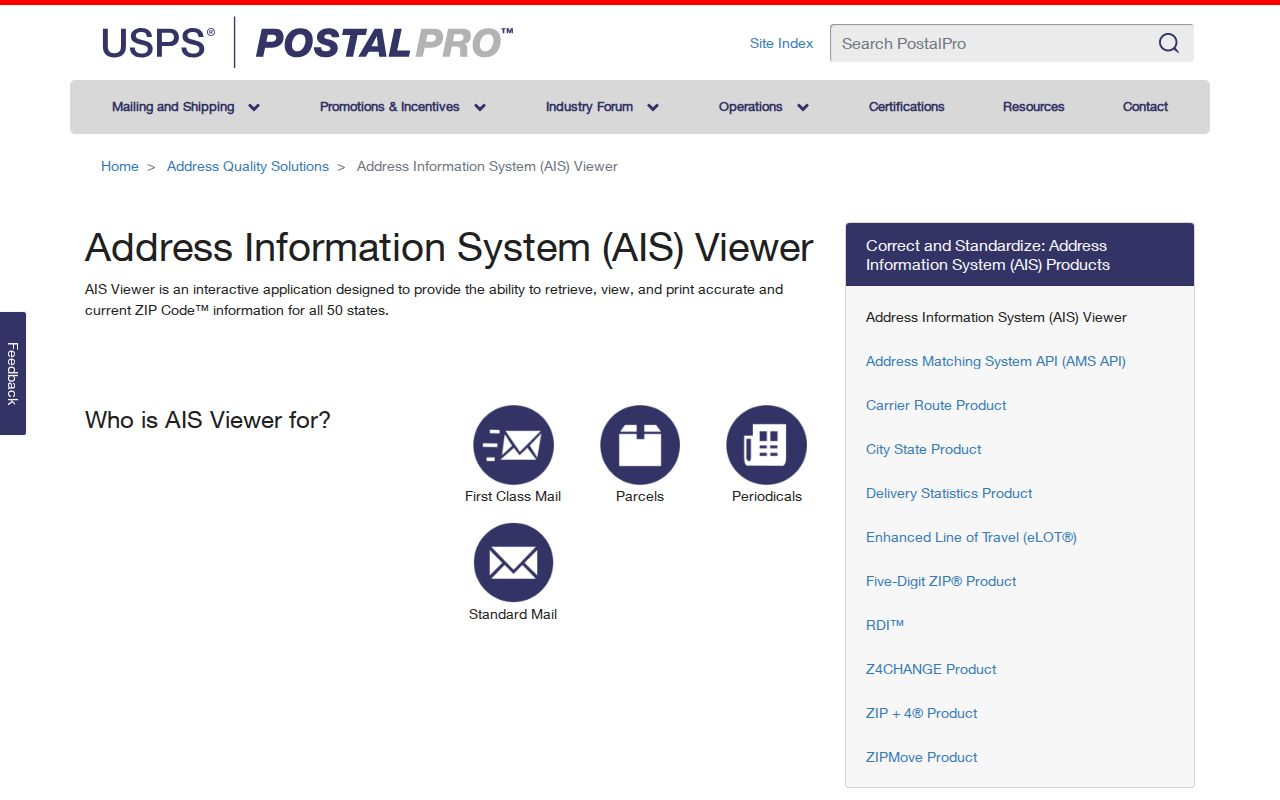
Its field categories show why a postal result needs a date stamp and should be matched to the physical parcel.
Search a Wake Forest ZIP Carefully
A ZIP code can organize a postal check, but the researched county systems do not offer a simple ZIP-wide resident search. Wake County Property Search has owner, Real Estate ID, location address, and PIN modes, not a dedicated ZIP field. iMAPS documents owner, address, place-of-interest, and intersection searches, also without a ZIP mode. The Register of Deeds uses party, document, and legal-description information rather than a ZIP filter. That distinction stops a postal code from being misread as a list of occupants.
- Run USPS address lookup with the full street address, city, and state to confirm the postal city, ZIP, and ZIP+4 if available.
- Search Wake County Real Estate Property Search by location address to obtain the situs address, REID or PIN, and county record context.
- Open Wake iMAPS to inspect the parcel and compare the returned location with map information.
- Use Town GIS limits and jurisdiction layers to determine whether Wake or Franklin County is the appropriate route.
- Send a deed, tax, court, or election request to the county custodian selected by the physical jurisdiction, not by the ZIP alone.
Once the ZIP has narrowed a search to a particular street, the Wake Forest street records route is the appropriate place to follow the modern address chain. Note: Preserve the postal result date because delivery routes and archived ZIP evidence can change over time.
Wake Forest Parcel Results by ZIP Context
The Wake County property system makes the postal distinction visible on a parcel card. It separates the assessed owner, mailing address, physical or situs address, parcel identifiers, deed reference, planning jurisdiction, and other property details. The researched sample at 546 N. Main St. showed a Wake Forest 27587 mailing address and a separate address field, along with REID, PIN, deed book and page, and planning jurisdiction. That sample is an inventory of fields, not a current ownership statement.
Use the property result to carry a REID or PIN into iMAPS and the deed index. Do not replace the site address with the mailing address, and do not assume the named owner is the current occupant. For a ZIP-based question, the returned ZIP is one fact in the record. Parcel location, legal description, and county are the facts that route a records search.
| Location address | The physical parcel or situs address used for an address search. |
|---|---|
| Mailing address | The address provided for notices; it can differ from the situs address. |
| REID and PIN | Property identifiers used to connect the card, map, and deed research. |
| Planning jurisdiction | A municipal context field that should be compared with town and county boundaries. |
Wake Forest ZIP Boundaries and City Lines
ZIP code boundaries and Wake Forest city limits answer different questions. A postal label can extend outside corporate limits, while the Town’s incorporated area crosses a Wake and Franklin County line. Town GIS provides Town Limits and Jurisdiction layers, and its boundary service also shows easements and Town Owned Property. Those map layers identify municipal geography. They do not create a postal ZIP layer or a resident roster.
- ZIP
- A postal routing code associated with a delivery area or postal-city result, not a town boundary.
- ZIP+4
- An added four digits that improve mailing precision. It does not identify a household or a person.
- PO Box ZIP
- A code used for post-office-box delivery. The research documents PO Box access at the Wake Forest branch, not a Wake Forest-only delivery boundary.
- Unique ZIP
- A postal term for a code assigned to one receiver. No Wake Forest unique ZIP was documented in the research.
- Carrier route
- A delivery-routing unit. It is not a municipal, deed, or election boundary.
Use the postal result as one label in a wider location check. Compare it with the county parcel, Town Limits layer, and municipal jurisdiction before selecting an office or interpreting a historic address.
Wake Forest ZIPs and Voter Geography
North Carolina’s voter lookup uses first name, last name, optional year of birth, county, and at least one voter-status choice. It has no ZIP mode. The county selector matters for Wake Forest because an address can fall in Wake or Franklin County. Results may show registration details, jurisdictions, polling place, sample ballot when available, absentee information, and voter history. Participation history does not show how a person voted.
Wake County publishes voter-data spreadsheets by precinct groups, and the state makes current and historical registration files available with limits and protected fields removed. Those files can be filtered for lawful civic analysis, but a ZIP should not be treated as a voter precinct or a shortcut around protected addresses. Confidential voter addresses may be protected through a qualifying order or the North Carolina Address Confidentiality Program. The safe route is the official North Carolina Voter Search, county selection, and only the information needed for the specific civic question.
Wake Forest Postal History Needs Dates
Old records can use a place name that does not match a current postal or municipal label. Wake Forest developed around the college campus, downtown, railroad, and later annexed mill-village area. Royall Mills was incorporated in 1907, its charter was repealed in 1945, and the village was annexed into Wake Forest in September 1977. A dated map, directory, deed, or newspaper may therefore use a period place name even when the postal address used today says Wake Forest.
The Town’s 2014 map and 2017-18 jurisdiction maps are dated records, not current ZIP-boundary proof. For a newly developed street, use the planning or development date, then identify the plat or subdivision record through the Register of Deeds. Keep the source date with the ZIP, municipal jurisdiction, and county so that a historical address is not silently rewritten into current geography.
Limits of a Wake Forest ZIP Search
A Wake Forest ZIP code directory is best used as a routing reference. It can help verify a postal assignment, compare a full address, and point toward the correct parcel map. It cannot prove current occupancy, choose a county custodian, provide a townwide address list, or reveal a person from a ZIP alone. No current official ZIP-boundary shapefile or USPS delivery-area map specific to Wake Forest was located in the research.
For a current postal check, use USPS. For a physical parcel, use the county property search and iMAPS. For municipal limits, use Town GIS. For deeds, court, tax, or election records, confirm the county first. That sequence is shorter than correcting a search after a postal city name has sent it to the wrong office.